Generic selectors
Exact matches only
Search in title
Search in content
Post Type Selectors
Generic selectors
Exact matches only
Search in title
Search in content
Post Type Selectors

Freeway Ridge, Black Gulch Trail

1 Review
Location Lake Isabella, CA
Rating Difficult,
Length 23.5mi
Time 5hrs

Vehicle Types

Overview

Network of challenging trails above Lake Isabella.

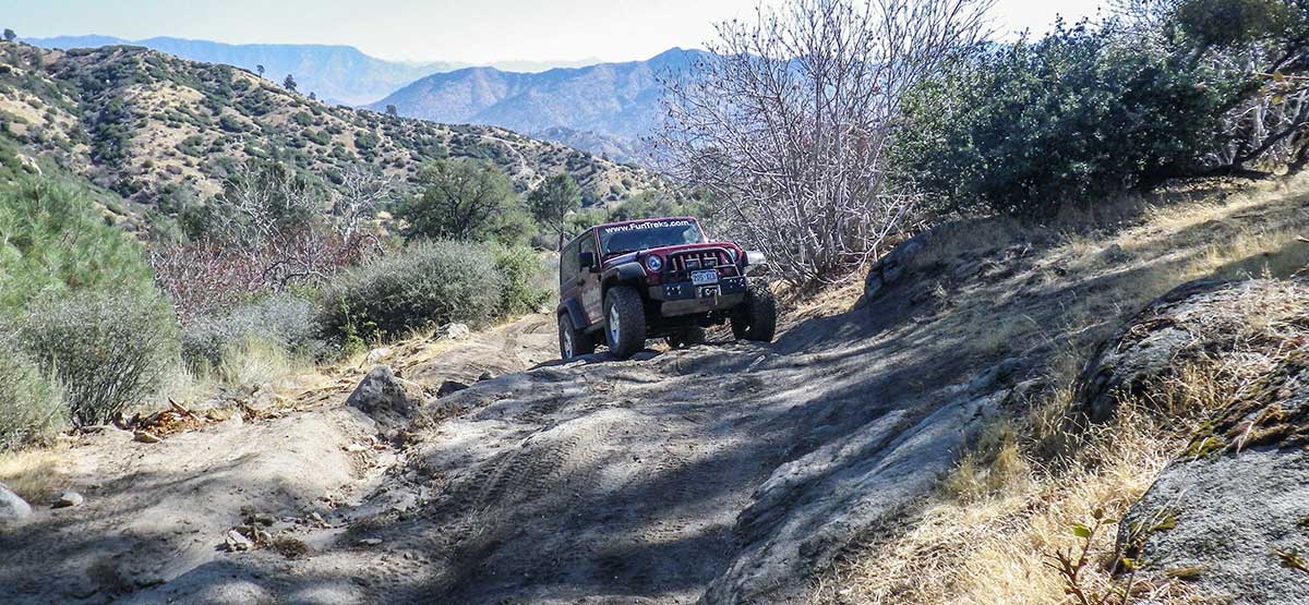
Trail circles around and climbs 4,000 feet to the top of 6,500- ft. Woodward Peak. This once active mining area features high views of Isabella Lake as you descend from top. Recommend you obtain MVUM to see all the roads in the area. For maximum challenge, we approach trail from the south side via Freeway Ridge. Lots of camping and side roads to explore for green-sticker vehicles north of Keyesville Road on BLM land.

Rating

Difficult
Trail Ratings Defined

Steep, rutted climb up Freeway Ridge at the start. Long, steep descent down 32E47. Deep ruts are very tippy in spots. High clearance and at least one locker recommended. Experienced drivers only.

Stats

Length

23.5mi

Time

5hrs

High Point

6,490ft

Best Time To Go

April-Dec

Current Conditions

(760) 379-5646, (661) 391-6000.Sequoia N.F., Kern River R.D. , BLM Bakersfield F.O.

Check the Weather

No updates yet.

Provide an Update

Free GPS download

Reviews

Rate this trail on a scale of 1 to 5.


×

Howie says

One of my favorite close to home trails. More of a moderate trail with some moderately difficult spots. It used to be twice as difficult at one time! Weather gets nicer at the top when it's baking in the valley! A lot of side routes to explore with quite a few dead ends so a map is extremely handy!!
by Webolutions Digitial Marketing Agency


Cancel Agree