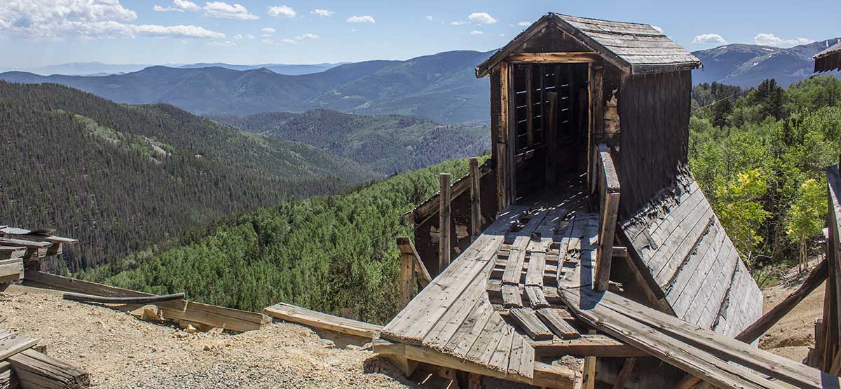
This is a fun trip with lots of standing mine buildings, especially at the Rawley Mine. See historic town of Bonanza, but respect privacy of the few residents that remain. Alternate return route is shown on map but not described in text. Although route-finding is tricky, it’s worth the effort if you seek more adventure. Many large dispersed camp spots along northern end of trail.
(719) 539-3591Rio Grande and San Isabel N.F.
Check the WeatherNo updates yet.
Provide an Update07/25/2023
Submitted by WGBertles
Ran trail north to south. Not many turnaround spots but trail in good shape and moderate. Didn’t go up to Rawley Mine but continued on to VillaGrove and did Hayden Pass. 2016 Jeep JKUR 2″ lift & 33″ tires.
08/08/2022
Submitted by Andy
I rode up CR 876 from 285 to the Colorado Belle Mine. I returned home almost the same way. The middle section of this road had an alternate path which I tried. I was surprised at the difficulty of the road going up. It gets steep in place where the road is covered with loose rocks. It is also just one vehicle wide. Lucky for me, I did not meet any other Wheelers. I took the north side alternate going down. I judged it to be a little easier. A lot of the road is a two-tracker road. Obviously, it does not see as much traffic. I can’t wait to go back and ride the other nearby trails in the area.
6/29/2020
Submitted by Kerry
Ran Rawley Mine/Bonanza trail backward. The trail is severely washed out and deeply rutted where Squirrel Creek crosses @ 38.33520, -106.15119. The uphill side of the creek has about a 24 – 30-inch ledge making it very difficult to cross for most.
6/22/2020
Submitted by Joe
My wife and I ride CanAm Outlander 570 ATVs. As our first trip with the trail books we purchased from Funtreks, I was impressed with how accurate the trail map is. An outstanding job is done by the staff at Funtreks! Note: When the book says Moderate, Moderate is no joke. The moderate portion of this trail is a TON of loose rocks in various sizes ranging from 4 to 12 inches in diameter, is often very eroded from rainfall/runoff and is a very narrow and steep (if you screw up, you go down a steep mountain) ledge. After 12.9 miles, we ran into the trail, which was not passable for our ATVs. It was apparently washed out. What was left of the trail was a three-foot vertical wall of mud with no way around without causing damage. I was disappointed because I was looking forward to seeing Bonanza and the mines, but all in all, we had a great trip!